 Privacy & Trust
GPS, Wi-Fi, or cell towers: how your phone actually knows where it is
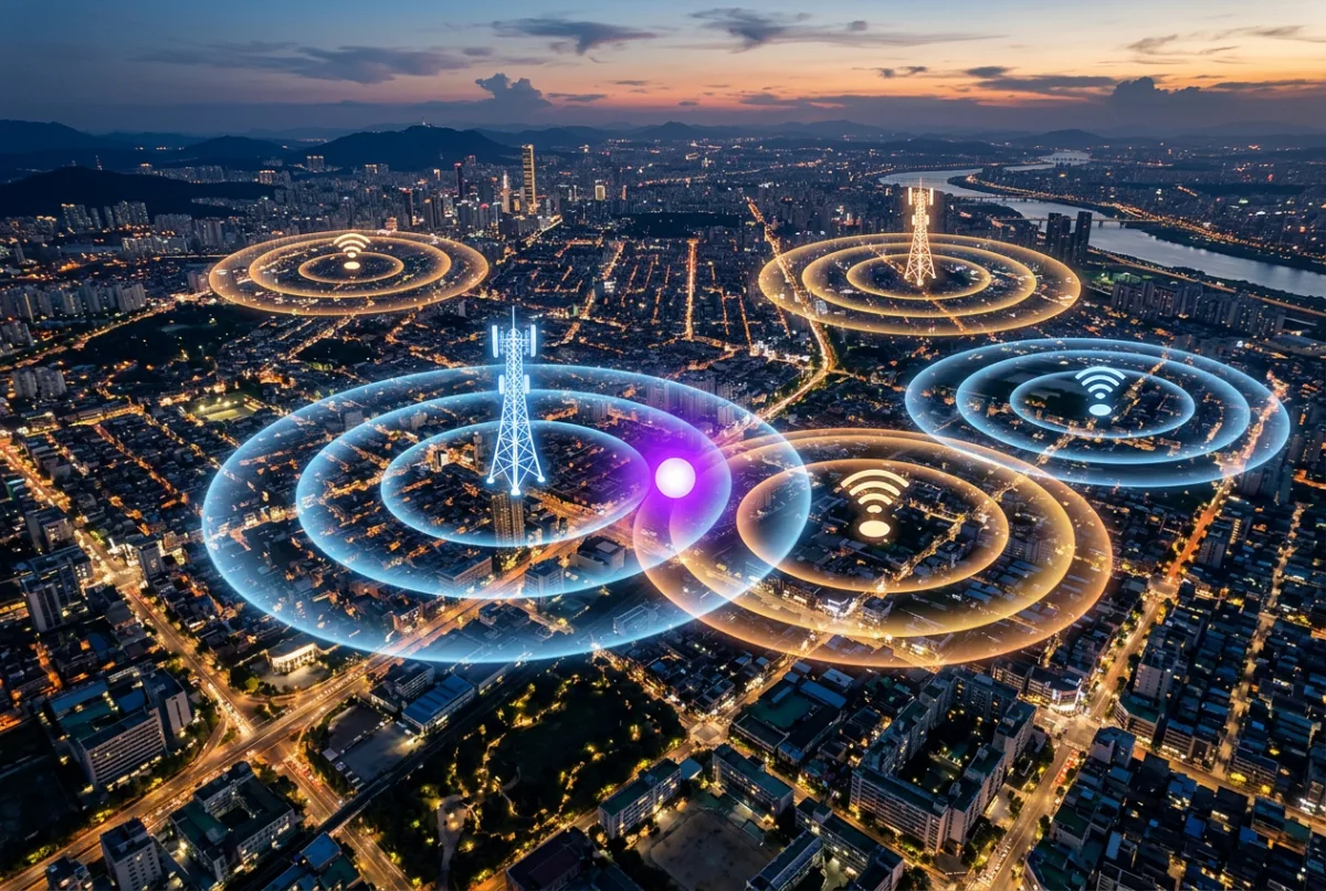
Your phone doesn't have one location sensor, it has three, and it blends them: GPS satellites for open sky, Wi-Fi access-point databases for indoors, and cell-tower triangulation as a rough fallback. Each is better in some environments and worse in others, and the accuracy circle on your map is an honest admission of doubt, not a bug. Indoors, a stale Wi-Fi database entry is the most common reason the dot lands on the wrong building.
When a family map shows someone standing in the wrong house, the instinct is to assume the app is broken. Usually it isn't, it's telling the truth about an honest guess, made from imperfect information, blended from three different systems that don't always agree.
Understanding those three systems doesn't require an engineering degree. It requires knowing what each one is actually good at, because that's what lets you read a family map sensibly instead of panicking every time a dot looks a little off. This guide covers GPS, Wi-Fi positioning and cell towers, how a phone fuses them into a single number, and what that number is honestly telling you.
It matters for more than curiosity. If you're relying on location for [walking home from the bus stop](/guides/walking-home-from-the-bus-stop) or deciding [is my child ready for a first phone](/guides/is-my-child-ready-for-a-first-phone), knowing why a dot drifts helps you trust the system correctly, neither blindly nor not at all.
What is GPS actually doing?
GPS, more accurately GNSS, since a modern phone also talks to Russian, European and Chinese satellite constellations, works by timing radio signals from satellites orbiting roughly 20,000 kilometres up. Each satellite constantly broadcasts the exact time it sent a signal. Your phone compares that to the time it received it, and from the tiny difference, works out how far away that satellite is. Do that with four or more satellites at once and the phone can triangulate its position in three dimensions to within a few metres.
The catch is that this only works cleanly with a relatively unobstructed view of the sky. GPS signals are faint by the time they've travelled from orbit, and they don't pass through concrete, steel, or much water. Outdoors, in open air, GPS is genuinely excellent, often accurate to within three to five metres. Indoors, underground, or in a dense city street lined with tall buildings, the signal either can't get through at all or bounces off buildings first, arriving late and throwing the timing calculation off. That's the “urban canyon” effect, and it's a real limit, not a design flaw.
How does Wi-Fi positioning work without connecting to any network?
This one surprises people: your phone doesn't need to join a Wi-Fi network to use it for location. It just needs to see the network's name and signal strength. Companies including Apple and Google maintain enormous databases mapping the physical location of Wi-Fi access points, built from years of phones anonymously reporting which networks they can see and where GPS placed them at the time. When your phone scans and sees three or four familiar-looking access points, it can compare the mix against that database and estimate its position, often to within ten to twenty metres, sometimes tighter.
This is what makes indoor location possible at all, since GPS mostly fails once you're inside a building. It's also the most common source of a confidently wrong dot, for a simple reason: those databases go stale. A router that moved house, a neighbour who bought a new one with the same manufacturer default name, or an access point that was mapped once years ago and never updated, any of these can pull your phone's estimate toward the wrong address, sometimes by a whole city block.
What do cell towers add?
Cell-tower triangulation is the oldest and roughest of the three. Every phone connected to a mobile network is in range of at least one tower, and usually several. By comparing signal strength and timing across nearby towers, a network can estimate a phone's position, but tower spacing varies wildly, from a few hundred metres apart in a city to many kilometres apart in rural areas, so the resulting accuracy ranges from a few hundred metres to several kilometres.
Cell triangulation exists as the fallback of last resort: it works almost anywhere there's signal, including underground car parks and basements where both GPS and Wi-Fi positioning can fail entirely, and it uses very little battery since the phone is talking to towers anyway to make calls and use data. It's the reason a phone can still show a rough location, a suburb, not a street, even in places the other two methods can't reach.
How does each method perform, side by side?
| Method | Typical accuracy | Where it works best | Battery cost |
|---|---|---|---|
| GPS / GNSS | 3–10 metres | Open sky, outdoors | High |
| Wi-Fi positioning | 10–30 metres | Indoors, dense urban areas | Low |
| Cell-tower triangulation | 150 metres–several km | Everywhere with signal, including underground | Very low |
No single row in that table is “the accurate one” and the others aren't “the inaccurate ones”, each is doing the job the others can't reach. That's the whole reason phones don't rely on just one.
Be Closer shows your whole family on one private map, free to start.
Consent-first, never sold, and gentle on your battery. iOS and Android.
What does “fused location” actually mean?
Modern phones don't pick one method and stick with it. They run a process usually called fused or hybrid location, which continuously blends whichever signals are currently available, weighted by how reliable each one seems in the moment. Walking down a street, GPS might dominate. Stepping into a shopping centre, the phone leans harder on Wi-Fi as GPS drops out. Duck into an underground car park and it falls back almost entirely on cell towers and, if available, motion sensors estimating movement from your last known position.
This handoff is mostly invisible and mostly works well, but it explains a specific kind of glitch: a dot that jumps abruptly when a phone crosses from one dominant signal to another, briefly showing an impossible location before settling. That jump is the fusion process re-weighting its inputs, not a tracking error in the sense of anything being watched incorrectly.
What is the accuracy circle actually telling you?
Most family map apps show a dot surrounded by a faint circle. That circle isn't decoration, it's a stated margin of error, usually meaning “the phone believes it is somewhere inside this circle, most likely near the centre.” A tight, small circle means the phone is fusing a strong GPS signal with recent, reliable Wi-Fi data. A wide circle spanning several hundred metres is an honest confession that the phone is currently working from cell towers alone, indoors, or with a weak signal.
Reading a family map without overreacting
- A wide accuracy circle usually means weak signal conditions, not that something is wrong.
- A dot on the wrong side of a building is more often a stale Wi-Fi database entry than a tracking failure.
- A dot that jumps and then settles is the phone switching between positioning methods.
- If a dot hasn't updated in a while, check the timestamp before the location, a 40-minute-old pin dressed up as live is the real problem. See How accurate is phone GPS? for more on reading timestamps honestly.
Why does this drain the battery so differently?
GPS is the most battery-hungry of the three because the radio has to stay actively listening for faint satellite signals, often for several seconds at a time to get a fix. Wi-Fi and cell-based positioning are much cheaper, since the phone is usually scanning for networks or talking to towers anyway for ordinary connectivity. This is exactly why apps that request “precise” location constantly, rather than only when useful, are the ones that visibly drain a battery, a topic covered in more depth in Why location sharing drains battery. A well-built family location app deliberately backs off to Wi-Fi or cell-based estimates when a tight GPS fix isn't needed, and only spends the GPS battery cost when accuracy actually matters, arriving somewhere, leaving a geofence, or an active check.
A location system that's honest about its uncertainty is more trustworthy than one that always looks confident.
Frequently asked questions

Daniel covers privacy, consent and the technology under the hood. A dad who reads the settings screens so you don't have to, he believes the best family tech is the kind you can explain to your kid in one sentence, and that nothing should ever be tracked in secret.
Our guides are written by Be Closer's editorial voices and reviewed by the team behind the app. Questions? support@becloser.com
Published · Updated